Why Lake Erie Yellow Perch Has Three Different Bag Limits
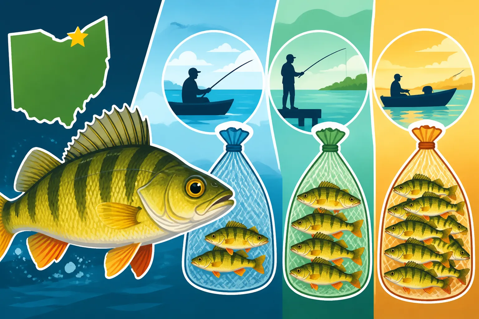
Ever find yourself staring at the Ohio fishing regulations booklet, scratching your head at why Lake Erie yellow perch have not one, not two, but three different daily bag limits? It can certainly feel confusing, especially when you're just trying to enjoy a peaceful day on the water and stay compliant. This isn't some arbitrary rule dreamt up to make things difficult; rather, it’s a carefully crafted management strategy designed to protect and sustain our incredible yellow perch fishery across the diverse ecosystems of Lake Erie. Let's dive deep into understanding these zones and why these varied limits are so essential.
Understanding Lake Erie's Perch Zones: Western, Central, and Eastern Basins
Lake Erie might look like one big body of water on a map, but biologically speaking, it's a dynamic system with distinct characteristics that greatly influence its fish populations. The Ohio Department of Natural Resources (ODNR), in collaboration with other state and provincial agencies around the lake, divides Lake Erie into three primary basins: the Western, Central, and Eastern Basins. Each of these zones possesses unique ecological features, from depth and temperature to nutrient levels and spawning habitats, all of which play a crucial role in the health and abundance of yellow perch. It's these differences that necessitate varied management strategies, including the daily bag limits you see in the regulations.
The Western Basin: A Perch Powerhouse
The Western Basin of Lake Erie, stretching roughly from Toledo to a line connecting Huron, Ohio, to Point Pelee in Ontario, is often considered the most productive part of the lake. It's relatively shallow, averaging around 25 feet deep, which means the water warms up quickly in the spring and holds a rich nutrient load. These conditions create an ideal environment for vast expanses of aquatic vegetation and a booming invertebrate population, which are the cornerstone of a healthy yellow perch diet and excellent spawning grounds.
Because of this natural bounty, the Western Basin typically sees the strongest yellow perch recruitment and often supports the highest population density. When you head out here, especially to spots like those near the Lake Erie Islands for Fishing Access, you're fishing in waters that historically produce robust numbers of perch. The sheer volume of fish means that, most years, anglers can enjoy a more generous daily bag limit without negatively impacting the overall population. However, even here, annual assessments determine the exact numbers, ensuring that we don't overfish this incredible resource.
Navigating the Central Basin: A Transition Zone
Moving eastward from the imaginary Huron-Pelee line, you enter the Central Basin, which extends to roughly Fairport Harbor, Ohio. This basin presents a fascinating transition. It's significantly deeper than the Western Basin, averaging around 60 feet, and in summer, it develops a pronounced thermocline—a distinct layer where warm surface water meets much colder, deeper water. This stratification of water impacts oxygen levels, especially in the deeper parts, and influences where yellow perch and their food sources can thrive.
While still productive, the Central Basin's ecological dynamics are different. Yellow perch populations here can be more susceptible to environmental changes, and their growth rates might differ from their western counterparts. The available habitat and food sources shift, leading to different population assessments. As a result, the daily bag limits in the Central Basin are often set more conservatively than the Western Basin, reflecting a more cautious approach to ensure sustainability. If you're wondering Where the Lake Erie Yellow Perch Central Zone Starts and Ends, it's important to know your coordinates. Many anglers use GPS or consult detailed navigation charts to be certain of their location when fishing near these invisible lines.
Exploring the Eastern Basin: Deeper Waters, Different Dynamics
Finally, the Eastern Basin of Lake Erie, stretching from Fairport Harbor all the way to Buffalo, New York, is the deepest and coldest part of the lake. Averaging over 80 feet deep and plummeting to depths of more than 200 feet, this basin has significantly different environmental conditions. The colder water and rocky bottom habitat mean fewer nutrients and a lower overall biological productivity compared to the western and central sections.
Consequently, yellow perch populations in the Eastern Basin are generally less abundant and may grow at a slower rate. Fishing pressure also plays a role, as the distribution of anglers and fishing effort can vary across the entire lake. To protect these more fragile perch populations and allow them to thrive, the Eastern Basin typically has the most conservative daily bag limits. This ensures that even with lower numbers, anglers can still enjoy the sport while ensuring that enough fish remain to reproduce and maintain a healthy ecosystem. Understanding these unique environments is key to appreciating Why Lake Erie Yellow Perch Has Three Different Bag Limits.
The Science Behind Varied Perch Limits: Population Dynamics and Management
The varying bag limits aren't arbitrary; they are the result of extensive scientific research, data collection, and collaborative efforts among the various jurisdictions bordering Lake Erie. Think of it like managing several distinct farms, each with different soil types and climates – you wouldn't plant the same crops or expect the same yield from each without careful consideration. The same goes for perch. Fisheries biologists meticulously monitor the health of the yellow perch populations in each basin, allowing them to make informed decisions that ensure sustainable fishing for everyone.
Ecological Factors Influencing Perch Populations
Several key ecological factors contribute to the distinct yellow perch population dynamics across the three basins. Spawning success is paramount. In the Western Basin, abundant shallow, warm waters and submerged vegetation provide excellent conditions for perch to lay their eggs and for larvae to hatch and grow. In contrast, the deeper, colder waters and different substrate types in the Central and Eastern Basins may lead to less consistent or lower spawning success.
Beyond spawning, factors like food availability (zooplankton and insect larvae), predator populations (such as walleye, especially in the Western Basin), and habitat quality all contribute. Changes in water temperature, clarity, and oxygen levels can also have significant impacts. For example, severe weather events or large algal blooms can affect specific basins differently, leading to localized declines or booms in perch numbers. Biologists analyze these intricate relationships to understand how many fish can be harvested sustainably.
The Role of Fishery Management and Data Collection
The ODNR, along with partners like the Ontario Ministry of Natural Resources and Forestry, Pennsylvania Fish and Boat Commission, and New York State Department of Environmental Conservation, works year-round to assess the health of Lake Erie's fish populations. They conduct extensive trawling surveys to estimate the abundance of young-of-the-year perch, gauge the size and age structure of adult populations, and monitor their overall health.
Creel surveys—where fisheries technicians interview anglers at boat ramps and marinas—provide invaluable data on catch rates, effort, and angler satisfaction. This information, combined with commercial catch data (where applicable), helps paint a comprehensive picture of the fishery. These statistics are then analyzed by committees like the Lake Erie Committee, which falls under the Great Lakes Fishery Commission. They use sophisticated population models to recommend Total Allowable Catches (TACs) for yellow perch in each basin. These TACs are then divided among the jurisdictions, and states like Ohio set their specific bag limits, which you can often find published on the ODNR website or in the current Ohio Fishing Regulations Every Angler Should Know booklet. It’s a lot of work, but it’s how we keep Lake Erie thriving.
Interstate Collaboration for a Shared Resource
Lake Erie is a shared resource, a massive body of water bordered by two countries, one Canadian province, and four U.S. states. This means that effective fisheries management requires constant communication and collaboration. The Lake Erie Committee plays a critical role in this, facilitating discussions and agreements on harvest quotas and management strategies. Without this cooperative effort, individual jurisdictions might implement conflicting regulations, leading to confusion, overfishing, or underutilization of the resource.
This spirit of cooperation ensures that decisions are made based on the health of the entire lake, not just one section. While Ohio sets its specific daily bag limits, these decisions are heavily influenced by the consensus and data shared among all the partners. It’s truly a testament to how complex and important our natural resources are, and why a unified approach, even with varied local rules, is absolutely essential.
Staying Compliant: How to Know Which Limit Applies to You
Understanding the "why" behind the different bag limits is important, but knowing "how" to stay compliant on the water is even more crucial. The invisible lines dividing Lake Erie's basins might not be marked by buoys, but wildlife officers take them very seriously. Ignorance of the law is never an excuse, and fishing in the wrong zone with the wrong limit can lead to fines and penalties. No one wants their fishing trip ruined by a misunderstanding, so let's go over how to ensure you're always following the rules.
Identifying Your Fishing Zone
The most important step is knowing precisely which basin you are fishing in. Modern technology makes this much easier than it used to be!
- GPS Devices: If you have a boat with a GPS chart plotter or even a handheld GPS device, you can easily mark the coordinates for the basin lines. For example, the dividing line between the Western and Central Basins often runs from the northern tip of Marblehead Peninsula (near Port Clinton) to Pelee Island, Ontario, and then continues south to the main shore near Huron, Ohio. Many chart plotters come pre-loaded with these jurisdictional boundaries.
- Fishing Apps: Several excellent fishing and navigation apps for smartphones and tablets utilize GPS to show your exact location relative to these boundaries. These can be incredibly handy for anglers using smaller boats or kayaks.
- Physical Maps: Even with digital tools, a good old-fashioned waterproof map of Lake Erie, showing the basin lines, can be an invaluable backup. You can often find these at bait shops or marine supply stores. You might even order one from Amazon to have on hand for quick reference.
- Local Knowledge: When launching from specific ports, especially in the Western Basin (like those near Port Clinton Ohio Boat Launch Locations) or Central Basin (near Sandusky Ohio Boat Launch Locations), local bait shops and marinas can often tell you exactly where the nearest basin line is relative to your launch point. Don't be shy about asking for advice!
Checking the Latest Regulations
Bag limits are not static; they can change from year to year based on the population assessments mentioned earlier. This means that the limit you fished under last year might not be the same this year. Always, always consult the most current regulations before heading out.
- ODNR Website: The Ohio Department of Natural Resources Division of Wildlife website is the most reliable source for up-to-date fishing regulations. They typically publish the new regulations booklet online well before the season starts. You can easily find the specific daily bag limits for Lake Erie Yellow Perch Daily Limit in the West Zone, Lake Erie Yellow Perch Daily Limit in the Central Zone, and Lake Erie Yellow Perch Daily Limit in the East Zone.
- Printed Booklets: Grab a physical copy of the Ohio Fishing Regulations booklet wherever you buy your Ohio Fishing License Guide for Residents and Nonresidents—most bait shops, sporting goods stores, and even some county auditors' offices will have them. Keep a copy on your boat or in your tackle box.
- Smartphone Apps: Some official or unofficial fishing apps also provide regulation summaries, but always double-check with the official ODNR source.
The new regulation year for fishing typically begins on March 1st or May 1st, so it's wise to review the rules around that time to ensure you’re current. Remember, these limits are in place to ensure we have healthy fish populations for years to come.
Practical Tips for Anglers on the Water
Even with the best intentions, things can get tricky on the water. Here are a few practical tips to help you stay compliant:
- Know Before You Go: Before you even leave the dock, have a clear plan of where you intend to fish and which basin that area falls into.
- Monitor Your Position: Especially if you're drifting or trolling, keep an eye on your GPS to ensure you don't inadvertently cross into another basin with a different limit.
- Count Your Catch: It's easy to lose track when the fishing is hot! Bring a clicker counter or use a simple system to keep an accurate tally of the yellow perch you've kept.
- Educate Your Crew: If you're fishing with friends or family, make sure everyone on board understands the specific bag limit for the zone you're in. This is especially important for Ohio Youth Fishing License Rules as they often follow the adult limits.
- Consider a Digital Scale: While not directly for limits, a good digital scale (easily found on Amazon) can help verify fish size if there are minimum length requirements for other species, just another way to stay organized and responsible.
By taking these steps, you'll not only stay on the right side of the law but also contribute to the long-term health of Lake Erie's incredible yellow perch fishery.
The Broader Picture: Why Ohio's Yellow Perch Management Matters
While a few fish might not seem like a big deal, the cumulative effect of hundreds of thousands of anglers on Lake Erie makes sound fisheries management absolutely vital. The varied bag limits for yellow perch aren't just about controlling individual catches; they're part of a much larger conservation effort that impacts the lake's ecosystem, local economies, and the future of fishing in Ohio. It's about preserving a cherished tradition and ensuring that future generations can experience the thrill of catching a Lake Erie jumbo perch.
Ensuring Sustainable Fishing for Future Generations
The core reason behind any fishing regulation, including the multi-tiered perch limits, is sustainability. Fisheries managers aim to achieve what's known as Maximum Sustainable Yield, meaning they want to allow as many fish as possible to be harvested without harming the long-term reproductive capacity of the population. By tailoring bag limits to the specific conditions and population health within each basin, the ODNR and its partners can respond to local fluctuations more effectively.
If a particular basin experiences a few years of poor perch recruitment due to environmental factors, a more conservative bag limit can be implemented quickly to protect the remaining adult fish and allow the population to rebound. Conversely, if a basin sees a booming population, limits can be adjusted upwards, providing more opportunities for anglers. This adaptive management approach is crucial for navigating the natural ups and downs of fish populations and safeguarding species like yellow perch, as highlighted in the broader Ohio Yellow Perch Fishing Guide. Without it, we risk severe declines, which could take decades to recover.
Economic Impact of Lake Erie's Perch Fishery
Let's not forget the significant economic impact that Lake Erie's yellow perch fishery has on Ohio's coastal communities. From bait and tackle shops in Port Clinton and Sandusky to charter boat services, hotels, restaurants, and gas stations, the dollars spent by anglers cascade through local economies. When anglers travel to fish, they invest in a variety of businesses. A healthy perch population, supported by effective management, means continued tourism and revenue for these communities.
Imagine if the yellow perch fishery collapsed due to poor management. The ripple effect would be devastating, leading to job losses and diminished local businesses. The careful balance achieved through varied bag limits directly supports the viability of these industries, making fishing not just a pastime but a critical economic engine for many towns along Lake Erie. It's why efforts to ensure the health of our fisheries, including understanding Ohio Fishing Season Dates and Effective Periods, are so widely supported.
Your Role as a Responsible Angler
As anglers, we all have a vital role to play in the stewardship of Lake Erie. Understanding and adhering to the fishing regulations, including the specific yellow perch bag limits for each basin, is the most fundamental contribution we can make. But it goes beyond just following the rules.
- Report Violations: If you witness illegal fishing activity, such as exceeding bag limits or fishing out of season, report it to the ODNR. This helps protect the resource for everyone.
- Practice Catch and Release Wisely: Even if you're within your limit, consider releasing some fish, especially larger breeding females, to ensure future generations. Learn proper handling techniques to maximize survival rates.
- Stay Informed: Keep up-to-date with current regulations and any changes. Read the annual fishing guide and follow ODNR updates.
- Support Conservation Efforts: Consider joining or supporting organizations dedicated to Lake Erie conservation and fisheries research.
By being informed, responsible, and engaged, you contribute to a legacy of sustainable fishing on Lake Erie. The three different bag limits for yellow perch might seem like a small detail, but they are a testament to the complex and dynamic efforts required to maintain one of Ohio's most beloved fisheries. So grab your gear, check your zone, and enjoy the phenomenal perch fishing that Lake Erie has to offer!
Disclaimer
Please remember that fishing regulations, including bag limits and zone boundaries, can change. Always consult the most current Ohio Department of Natural Resources (ODNR) fishing regulations before heading out on the water. This article provides general information and should not be considered a substitute for official legal guidance.